
Fitxer:Kudaka Island,Nanjo.jpg

Mida d'aquesta previsualització: 800 × 392 píxels. Altres resolucions: 320 × 157 píxels | 640 × 314 píxels | 1.024 × 502 píxels | 1.280 × 628 píxels | 2.560 × 1.256 píxels | 5.300 × 2.600 píxels.
Fitxer original (5.300 × 2.600 píxels, mida del fitxer: 4,07 Mo, tipus MIME: image/jpeg)
| Aquest fitxer i la informació mostrada a continuació provenen del dipòsit multimèdia lliure Wikimedia Commons. |
Resum
| Descripció |
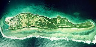
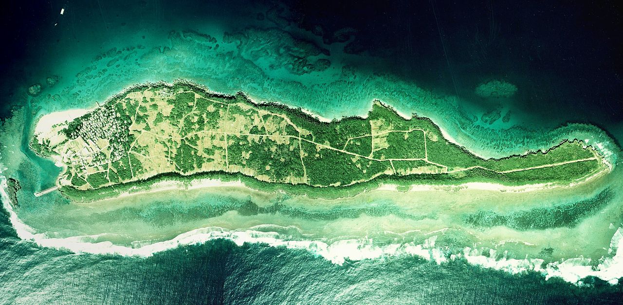
English: Kudaka Island, Nanjo, Okinawa, Japan.
日本語: 久高島(沖縄県南城市)
国土交通省の国土画像情報(カラー空中写真)を元に作成。
|
| Data | |
| Font | COK-77-1-C87-6, COK-77-1-C87-7, COK-77-1-C87-8 |
| Autor |
English: Geospatial Information Authority of Japan
日本語: 国土地理院 |
| Posició de la càmera | | Aquesta i altres imatges properes a: OpenStreetMap |
|---|
| Això és una imatge retocada, cosa que vol dir que ha estat alterada digitalment de la seva versió original. Modificacions: Combined 3 aerial photos and cropped. Modificacions fetes per Kugel~commonswiki.
|
Llicència

|
El titular dels drets d'autor d'aquest arxiu, the Ministry of Land, Infrastructure, Transport and Tourism of Japan, permet que qualsevol pugui usar-lo per a qualsevol propòsit, sempre que el titular dels drets d'autor sigui reconegut correctament. La redistribució, les obres derivades, l'ús comercial, i qualsevol altre ús està permès. |
Reconeixement:
Copyright © National Land Image Information (Color Aerial Photographs), Ministry of Land, Infrastructure, Transport and Tourism
|
 |
This image is copyrighted by the Ministry of Land, Infrastructure, Transport and Tourism of Japan. For terms of use, see the stipulation to use of National Land Information (in Japanese) and message from MLIT (in Japanese and English). When you display this image on an article, include the following phrase in the description: "Made based on National Land Image Information (Color Aerial Photographs), Ministry of Land, Infrastructure, Transport and Tourism".
|
Historial del fitxer
Cliqueu una data/hora per veure el fitxer tal com era aleshores.
| Data/hora | Miniatura | Dimensions | Usuari/a | Comentari | |
|---|---|---|---|---|---|
| actual | 08:27, 20 març 2017 | | 5.300 × 2.600 (4,07 Mo) | Kugel~commonswiki | Combined photos using by stitching software |
| 10:44, 17 oct 2013 | 5.529 × 1.185 (2,36 Mo) | Kugel~commonswiki | renewal | ||
| 12:50, 31 març 2010 |  | 5.425 × 2.921 (1,88 Mo) | Kugel~commonswiki | {{Information |Description={{en|1=Kudaka Island, Nanjo, Okinawa, Japan.}} {{ja|1=久高島(沖縄県南城市)}} |Source=Japanese Ministry of Land, Infrastructure, Transport and Tourism[http://w3land.mlit.go.jp/cgi-bin/WebGIS2/WC_AirPhoto.cgi?IT=p&DT= |
Ús del fitxer
No hi ha pàgines que utilitzin aquest fitxer.
Ús global del fitxer
Utilització d'aquest fitxer en altres wikis:
- Utilització a cs.wikipedia.org
- Utilització a ja.wikipedia.org
- Utilització a zh.wikipedia.org