
Fitxer:Latzina1888.jpg
Fitxer original (3.190 × 5.403 píxels, mida del fitxer: 3,32 Mo, tipus MIME: image/jpeg)
| Aquest fitxer i la informació mostrada a continuació provenen del dipòsit multimèdia lliure Wikimedia Commons. |
| Descripció |
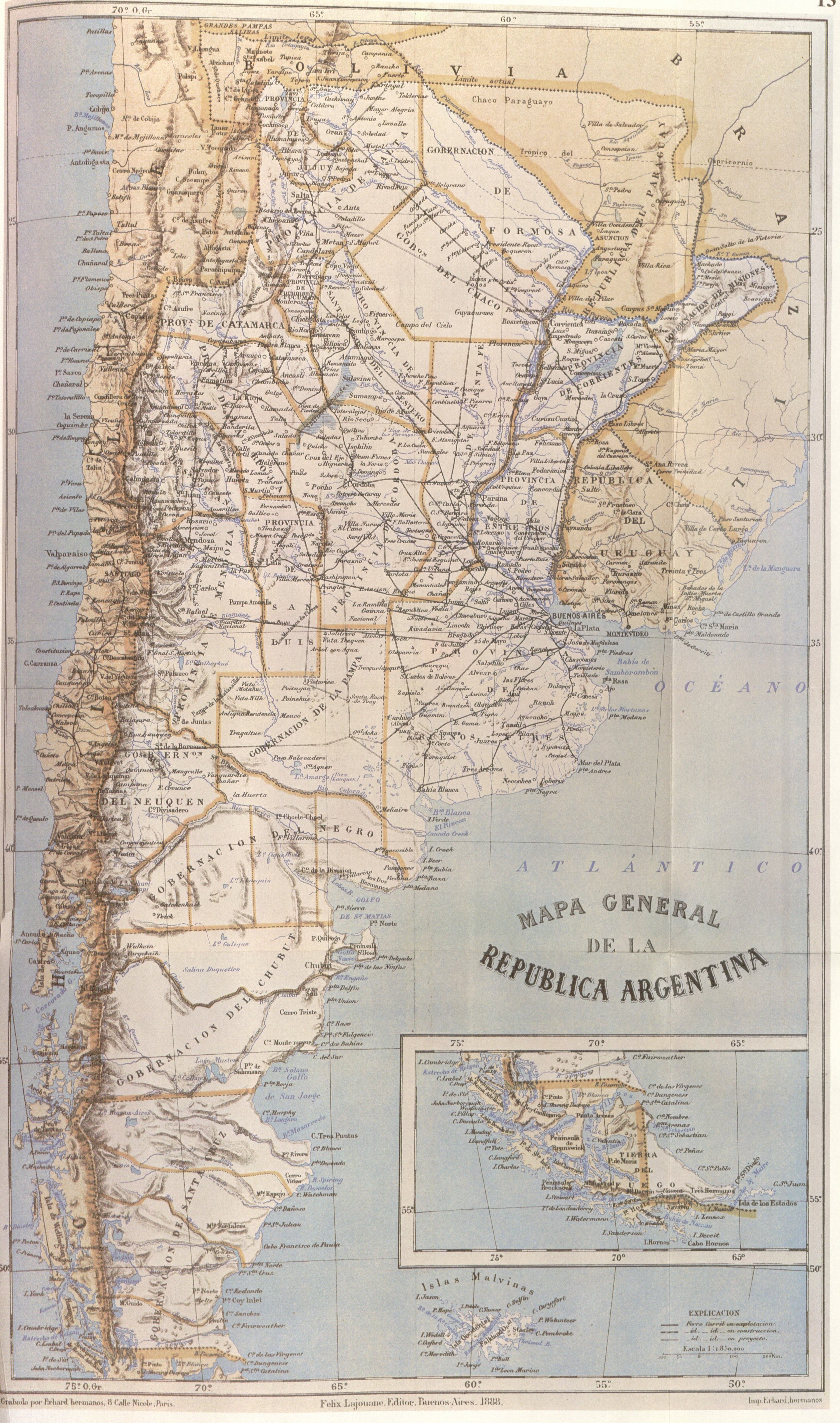
"This map, partially reproduced here, is included in the Geography of the Argentine Republic published in Buenos Aires in 1888 by Francisco Latzina, National Director of the Argentine Statistics and member of numerous scientific societies. In the extreme southern region, the international boundary is traced along the centre of the Beagle Channel and stretches to the south of the Isla de los Estados. Here it shows Picton, Nueva and Lennox Islands and all other islands and islets extending southward as far as Cape Horn as being undr Chilean sovereignty." |
||||||||||||||||
| Data | |||||||||||||||||
| Font | "El Conflicto del Beagle, edited by the chilean Foreign Affairs Office, 1978, Switzerland" | ||||||||||||||||
| Autor |
|
||||||||||||||||
| Permís (Com reutilitzar aquest fitxer) |
|
||||||||||||||||
| Altres versions | |||||||||||||||||

Historial del fitxer
Cliqueu una data/hora per veure el fitxer tal com era aleshores.
| Data/hora | Miniatura | Dimensions | Usuari/a | Comentari | |
|---|---|---|---|---|---|
| actual | 21:57, 23 set 2007 | | 3.190 × 5.403 (3,32 Mo) | Keysanger | {{Information |Description="This map, partially reproduced here, is included in the Geography of the Argentine Republic published in Buenos Aires in 1888 by Francisco Latzina, National Director of the Argentine Statistics and member of numerous scientific |
Ús del fitxer
La pàgina següent utilitza aquest fitxer:
Ús global del fitxer
Utilització d'aquest fitxer en altres wikis:
- Utilització a de.wikipedia.org
- Utilització a en.wikipedia.org
- Utilització a eo.wikipedia.org
- Utilització a es.wikipedia.org
- Utilització a fr.wikipedia.org
- Utilització a pl.wikipedia.org
- Utilització a uk.wikipedia.org