
Fitxer:Loo Winds India Pakistan Map.jpg
Mida d'aquesta previsualització: 448 × 600 píxels. Altres resolucions: 179 × 240 píxels | 359 × 480 píxels | 680 × 910 píxels.
Fitxer original (680 × 910 píxels, mida del fitxer: 144 Ko, tipus MIME: image/jpeg)
| Aquest fitxer i la informació mostrada a continuació provenen del dipòsit multimèdia lliure Wikimedia Commons. |
| Descripció |
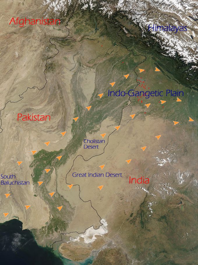
English: The orange arrows indicate how the Loo originates in the deserts of Thar (Great Indian Desert), Cholistan and Baluchistan and flow eastwards towards the entire western part of the Indo-Gangetic plain. |
|||||
| Font | NASA (http://www.visibleearth.nasa.gov/view_rec.php?id=4716) | |||||
| Autor | NASA | |||||
| Permís (Com reutilitzar aquest fitxer) |
|

This is derived from an original NASA satellite map modified (by me) to indicate directions of Loo winds. To remove any doubt, I also hereby release any changes added to the original image by me to the public domain. No rights whatsoever are claimed.
Historial del fitxer
Cliqueu una data/hora per veure el fitxer tal com era aleshores.
| Data/hora | Miniatura | Dimensions | Usuari/a | Comentari | |
|---|---|---|---|---|---|
| actual | 23:21, 20 juny 2009 | | 680 × 910 (144 Ko) | Hunnjazal | {{Information |Description={{en|1=The orange arrows indicate how the Loo originates in the deserts of Thar (Great Indian Desert), Cholistan and Baluchistan and flow eastwards towards the entire western part of the Indo-Gangetic plain.}} |Source=NASA (http |
Ús del fitxer
La pàgina següent utilitza aquest fitxer:
Ús global del fitxer
Utilització d'aquest fitxer en altres wikis:
- Utilització a ar.wikipedia.org
- Utilització a bh.wikipedia.org
- Utilització a bn.wikipedia.org
- Utilització a en.wikipedia.org
- Utilització a es.wikipedia.org
- Utilització a ml.wikipedia.org
- Utilització a nn.wikipedia.org
- Utilització a pa.wikipedia.org
- Utilització a ru.wikipedia.org
- Utilització a uk.wikipedia.org
- Utilització a www.wikidata.org