Fitxer:Map of Singapore.jpg
Aparença
Map_of_Singapore.jpg (353 × 354 píxels, mida del fitxer: 43 Ko, tipus MIME: image/jpeg)
Historial del fitxer
Cliqueu una data/hora per veure el fitxer tal com era aleshores.
| Data/hora | Miniatura | Dimensions | Usuari/a | Comentari | |
|---|---|---|---|---|---|
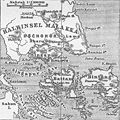
| actual | 01:36, 6 des 2006 |  | 353 × 354 (43 Ko) | Electionworld | {{ew|en|WhistperToMe}} 1888 German map of Singapore {{PD-old}} |
Ús del fitxer
La pàgina següent utilitza aquest fitxer:
Ús global del fitxer
Utilització d'aquest fitxer en altres wikis:
- Utilització a ast.wikipedia.org
- Utilització a da.wikipedia.org
- Utilització a de.wikipedia.org
- Utilització a en.wikipedia.org
- Utilització a eo.wikipedia.org
- Utilització a es.wikipedia.org
- Utilització a eu.wikipedia.org
- Utilització a fr.wikipedia.org
- Utilització a gl.wikipedia.org
- Utilització a he.wikipedia.org
- Utilització a hi.wikipedia.org
- Utilització a ko.wikipedia.org
- Utilització a ms.wikipedia.org
- Utilització a nl.wikipedia.org
- Utilització a pnb.wikipedia.org
- Utilització a simple.wikipedia.org
- Utilització a th.wikipedia.org
- Utilització a tr.wikipedia.org
- Utilització a zh.wikipedia.org


