
Fitxer:Moheli (Comoros) map.jpg

No hi ha cap versió amb una resolució més gran.
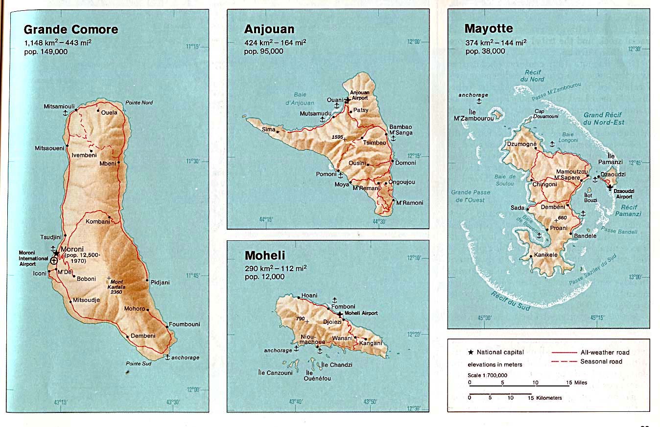
Moheli_(Comoros)_map.jpg (354 × 320 píxels, mida del fitxer: 19 Ko, tipus MIME: image/jpeg)
| Aquest fitxer i la informació mostrada a continuació provenen del dipòsit multimèdia lliure Wikimedia Commons. |
Resum
| Descripció | Moheli. From The Indian Ocean Atlas, CIA, 1976. |
| Data | |
| Font | University of Texas Libraries, Perry-Castañeda Library Map Collection: Comoros Maps (extracted) |
| Autor | CIA |
| Altres versions |

_map.jpg?uselang=ca)
Llicència
| This image is a work of a Central Intelligence Agency employee, taken or made as part of that person's official duties. As a Work of the United States Government, this image or media is in the public domain in the United States.
|

|
Registre original de càrregues
All following user names refer to en.wikipedia.
- 2003-08-06 17:36 Pascal 354×320× (19883 bytes) Moheli (Comoros) map
Historial del fitxer
Cliqueu una data/hora per veure el fitxer tal com era aleshores.
| Data/hora | Miniatura | Dimensions | Usuari/a | Comentari | |
|---|---|---|---|---|---|
| actual | 21:41, 25 abr 2009 | | 354 × 320 (19 Ko) | File Upload Bot (Magnus Manske) | {{BotMoveToCommons|en.wikipedia|year={{subst:CURRENTYEAR}}|month={{subst:CURRENTMONTHNAME}}|day={{subst:CURRENTDAY}}}} {{Information |Description={{en|Map of Moheli (Comoros)}} |Source=Transferred from [http://en.wikipedia.org en.wikipedia]; transferred |
Ús del fitxer
La pàgina següent utilitza aquest fitxer:
Ús global del fitxer
Utilització d'aquest fitxer en altres wikis:
- Utilització a be.wikipedia.org
- Utilització a ceb.wikipedia.org
- Utilització a de.wikipedia.org
- Utilització a en.wikipedia.org
- Utilització a eo.wikipedia.org
- Utilització a fa.wikipedia.org
- Utilització a fi.wikipedia.org
- Utilització a frr.wikipedia.org
- Utilització a hu.wikipedia.org
- Utilització a mg.wikipedia.org
- Utilització a ms.wikipedia.org
- Utilització a nl.wikipedia.org
- Utilització a sv.wikipedia.org
- Utilització a tr.wikipedia.org
- Utilització a uk.wikipedia.org
- Utilització a www.wikidata.org
_map.jpg)