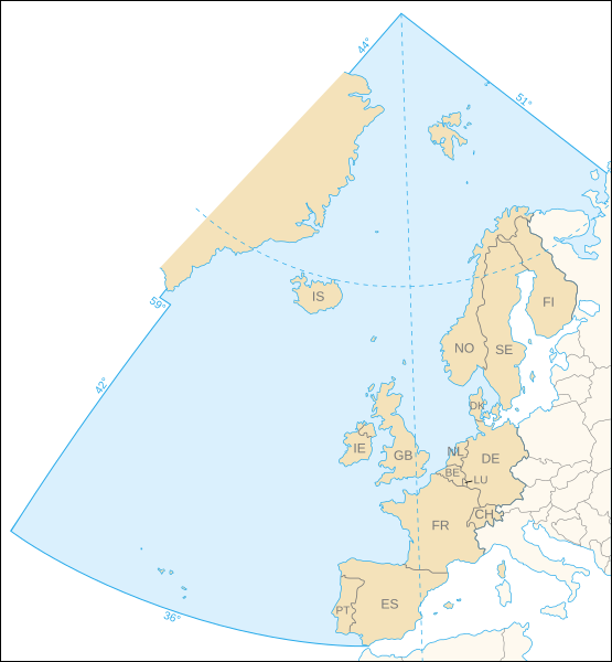
Fitxer:OSPAR Commission area map.svg

Mida d'aquesta previsualització PNG del fitxer SVG: 555 × 600 píxels. Altres resolucions: 222 × 240 píxels | 444 × 480 píxels | 710 × 768 píxels | 947 × 1.024 píxels | 1.894 × 2.048 píxels | 740 × 800 píxels.
Fitxer original (fitxer SVG, nominalment 740 × 800 píxels, mida del fitxer: 202 Ko)
Historial del fitxer
Cliqueu una data/hora per veure el fitxer tal com era aleshores.
| Data/hora | Miniatura | Dimensions | Usuari/a | Comentari | |
|---|---|---|---|---|---|
| actual | 23:44, 9 nov 2006 |  | 740 × 800 (202 Ko) | Sting | White background |
| 23:31, 9 nov 2006 |  | 740 × 800 (202 Ko) | Sting | {{Information| |Description=Map of the marine area and the 15 contracting parties of the OSPAR Commission for the protection of the marine environment of the North-East Atlantic |Source=Own work, based upon [http://www.ospar.org/eng/html/welcome.html the |
Ús del fitxer
La pàgina següent utilitza aquest fitxer:
Ús global del fitxer
Utilització d'aquest fitxer en altres wikis:
- Utilització a ast.wikipedia.org
- Utilització a cs.wikipedia.org
- Utilització a da.wikipedia.org
- Utilització a de.wikipedia.org
- Utilització a de.wiktionary.org
- Utilització a en.wikipedia.org
- Utilització a es.wikipedia.org
- Utilització a fr.wikipedia.org
- Utilització a gl.wikipedia.org
- Utilització a nl.wikipedia.org
- Utilització a no.wikipedia.org
- Utilització a pt.wikipedia.org
- Utilització a sk.wikipedia.org
- Utilització a sv.wikipedia.org

