
Fitxer:Somalia pol02.jpg

Mida d'aquesta previsualització: 500 × 599 píxels. Altres resolucions: 200 × 240 píxels | 400 × 480 píxels | 641 × 768 píxels | 1.078 × 1.292 píxels.
Fitxer original (1.078 × 1.292 píxels, mida del fitxer: 698 Ko, tipus MIME: image/jpeg)
| Aquest fitxer i la informació mostrada a continuació provenen del dipòsit multimèdia lliure Wikimedia Commons. |
Resum
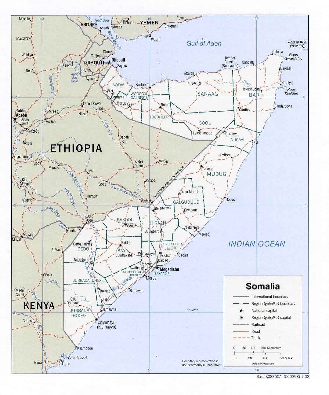
Perry-Castañeda Library - Political map of Somalia.
According to the source's table of contents, this is a CIA map, thus placing the image in the public domain.
Llicència
| This image is a work of a Central Intelligence Agency employee, taken or made as part of that person's official duties. As a Work of the United States Government, this image or media is in the public domain in the United States.
|

|
Historial del fitxer
Cliqueu una data/hora per veure el fitxer tal com era aleshores.
| Data/hora | Miniatura | Dimensions | Usuari/a | Comentari | |
|---|---|---|---|---|---|
| actual | 19:55, 16 març 2019 | | 1.078 × 1.292 (698 Ko) | Goran tek-en | Changed Giohar to Jowhar and added Adado as requested by {{u|Buckshot06}} |
| 09:47, 14 des 2005 |  | 1.078 × 1.292 (202 Ko) | Gyrofrog | Political map of Somalia.<br /> According to the source's [http://www.lib.utexas.edu/maps/somalia.html table of contents], this is a CIA map, thus placing the image in the public domain. |
Ús del fitxer
No hi ha pàgines que utilitzin aquest fitxer.
Ús global del fitxer
Utilització d'aquest fitxer en altres wikis:
- Utilització a ast.wikipedia.org
- Utilització a bg.wikipedia.org
- Utilització a ckb.wikipedia.org
- Utilització a en.wikipedia.org
- Utilització a fa.wikipedia.org
- Utilització a fi.wikipedia.org
- Utilització a id.wikipedia.org
- Utilització a ja.wikipedia.org
- Utilització a lt.wikipedia.org
- Utilització a mzn.wikipedia.org
- Utilització a nl.wikipedia.org
- Utilització a ru.wikipedia.org
- Utilització a sk.wikipedia.org
- Utilització a tg.wikipedia.org
- Utilització a uk.wikipedia.org