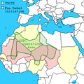
Fitxer:Southern Sudan Civil War.svg

Mida d'aquesta previsualització PNG del fitxer SVG: 800 × 581 píxels. Altres resolucions: 320 × 232 píxels | 640 × 465 píxels | 1.024 × 743 píxels | 1.280 × 929 píxels | 2.560 × 1.858 píxels | 1.561 × 1.133 píxels.
Fitxer original (fitxer SVG, nominalment 1.561 × 1.133 píxels, mida del fitxer: 1,71 Mo)
Historial del fitxer
Cliqueu una data/hora per veure el fitxer tal com era aleshores.
| Data/hora | Miniatura | Dimensions | Usuari/a | Comentari | |
|---|---|---|---|---|---|
| actual | 21:20, 14 des 2021 |  | 1.561 × 1.133 (1,71 Mo) | Borysk5 | Added new map based on 2021 IPIS interactive roadblock map: https://ipisresearch.be/publication/checkpoint-economy-the-political-economy-of-checkpoints-in-south-sudan-ten-years-after-independence/ (selected SPLA-IO and SPLA checkpoints) |
| 19:19, 22 març 2020 |  | 1.561 × 1.133 (292 Ko) | Borysk5 | Update based on template | |
| 23:27, 1 abr 2016 |  | 1.561 × 1.133 (255 Ko) | Ermanarich | Derived from the Template. Opposition forces arrived in Juba as part of implementation of the Agreement on the Resolution of the Conflict. Wau, Malakal, Nasir, Mir Mir and Rupkuai contested, some v... | |
| 07:50, 21 feb 2016 |  | 1.561 × 1.133 (231 Ko) | Oganesson007 | User created page with UploadWizard |
Ús del fitxer
La pàgina següent utilitza aquest fitxer:
Ús global del fitxer
Utilització d'aquest fitxer en altres wikis:
- Utilització a ar.wikipedia.org
- Utilització a az.wikipedia.org
- Utilització a bn.wikipedia.org
- Utilització a cs.wikipedia.org
- Utilització a de.wikipedia.org
- Utilització a de.wikivoyage.org
- Utilització a en.wikipedia.org
- Utilització a eo.wikipedia.org
- Utilització a es.wikipedia.org
- Utilització a fr.wikipedia.org
- Utilització a he.wikipedia.org
- Utilització a hi.wikipedia.org
- Utilització a id.wikipedia.org
- Utilització a it.wikipedia.org
- Utilització a ja.wikipedia.org
- Utilització a ko.wikipedia.org
- Utilització a lv.wikipedia.org
- Utilització a pt.wikipedia.org
- Utilització a ru.wikipedia.org
- Utilització a sr.wikipedia.org
- Utilització a te.wikipedia.org
- Utilització a th.wikipedia.org
- Utilització a tr.wikipedia.org
- Utilització a tum.wikipedia.org
- Utilització a www.wikidata.org
- Utilització a zh.wikipedia.org


