
Fitxer:UNIKOM map 2001.png

Fitxer original (3.096 × 2.056 píxels, mida del fitxer: 1,14 Mo, tipus MIME: image/png)
| Aquest fitxer i la informació mostrada a continuació provenen del dipòsit multimèdia lliure Wikimedia Commons. |
| Descripció |
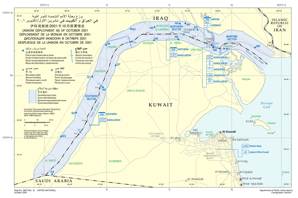
English: United Nations Iraq–Kuwait Observation Mission map deployment as of October 2001.
Español: Mapa del despliegue de la Misión de Observación de las Naciones Unidas para Irak y Kuwait a octubre de 2001. |
|||
| Data | ||||
| Font | United Nations Cartographic Section | |||
| Autor | United Nations | |||
| Permís (Com reutilitzar aquest fitxer) |
|

Historial del fitxer
Cliqueu una data/hora per veure el fitxer tal com era aleshores.
| Data/hora | Miniatura | Dimensions | Usuari/a | Comentari | |
|---|---|---|---|---|---|
| actual | 02:08, 24 oct 2011 | | 3.096 × 2.056 (1,14 Mo) | Montgomery | {{Information |Description ={{en|1=United Nations Iraq–Kuwait Observation Mission map deployment as of October 2001.}} {{es|1=Mapa del despliegue de la Misión de Observación de las Naciones Unidas para Irak y Kuwait a octubre de 2001.}} |Source |
Ús del fitxer
Les 2 pàgines següents utilitzen aquest fitxer:
Ús global del fitxer
Utilització d'aquest fitxer en altres wikis:
- Utilització a es.wikipedia.org
- Utilització a nl.wikipedia.org
- Utilització a no.wikipedia.org
- Utilització a pt.wikipedia.org
- Utilització a uk.wikipedia.org
- Utilització a www.wikidata.org