
Fitxer:Země Koruny české.jpg
Fitxer original (2.847 × 2.260 píxels, mida del fitxer: 1,11 Mo, tipus MIME: image/jpeg)
| Aquest fitxer i la informació mostrada a continuació provenen del dipòsit multimèdia lliure Wikimedia Commons. |
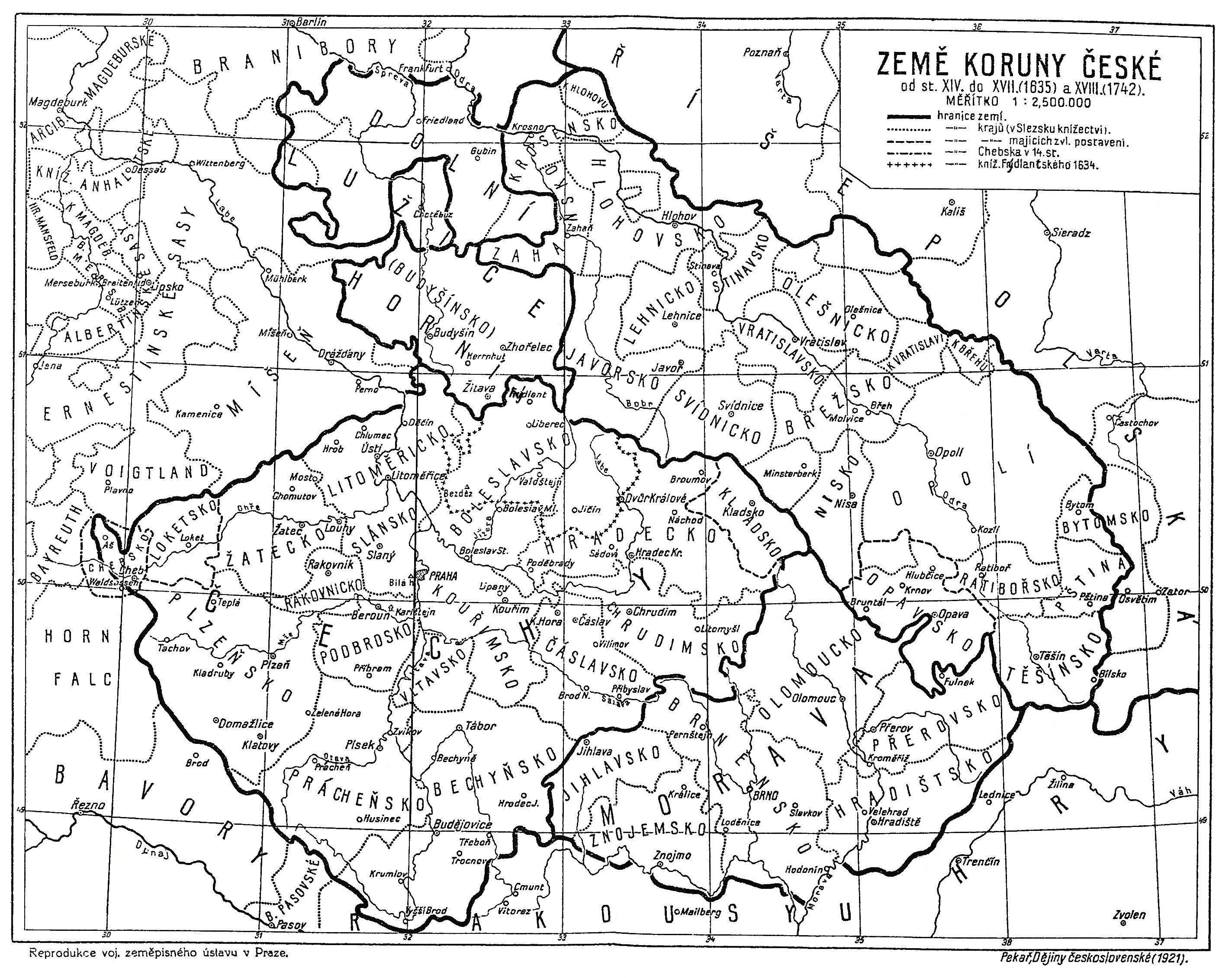
| Descripció | Map of the Lands of the Bohemian Crown from the 14th century until the year 1742. The descriptions are in Czech. |
| Data | |
| Font | Book Dějiny československé by Josef Pekař, 1991 reprint (ISBN 80-900354-2-6) of the original 1921 edition. |
| Autor | Desconegut |
|
Això és una mera fotografia d'una obra d'art bidimensional en domini públic. L'obra d'art original és en domini públic pel següent motiu:
La posició oficial de la Fundació Wikimedia és que «les reproduccions fidels d'obres d'art bidimensionals de domini públic són en domini públic».
Per tant, aquesta reproducció fotogràfica també es considera en domini públic als Estats Units. En altres jurisdiccions la reutilització d'aquest contingut pot estar restringida; vegeu Reuse of PD-Art photographs per a més informació. | ||||
Historial del fitxer
Cliqueu una data/hora per veure el fitxer tal com era aleshores.
| Data/hora | Miniatura | Dimensions | Usuari/a | Comentari | |
|---|---|---|---|---|---|
| actual | 14:01, 14 gen 2022 | | 2.847 × 2.260 (1,11 Mo) | Jan Šlendr | Reverted to version as of 09:52, 29 March 2013 (UTC) - mistake |
| 14:01, 14 gen 2022 |  | 2.847 × 2.260 (1,89 Mo) | Jan Šlendr | moravsko-slezská hranice | |
| 11:52, 29 març 2013 |  | 2.847 × 2.260 (1,11 Mo) | Fext | Fixed | |
| 16:01, 23 jul 2008 |  | 2.887 × 2.260 (1,19 Mo) | Geographus | {{Information |Description= Map of the Lands of the Bohemian Crown from the 14th century until the year 1742. The descriptions are in Czech. |Source= Book Dějiny československé by Josef Pekař, 1991 reprint (ISBN 80-900354-2-6) of the original 1921 ed |
Ús del fitxer
La pàgina següent utilitza aquest fitxer:
Ús global del fitxer
Utilització d'aquest fitxer en altres wikis:
- Utilització a ar.wikipedia.org
- Utilització a ba.wikipedia.org
- Utilització a be.wikipedia.org
- Utilització a cs.wikipedia.org
- Utilització a da.wikipedia.org
- Utilització a de.wikipedia.org
- Utilització a el.wikipedia.org
- Utilització a en.wikipedia.org
- Utilització a eo.wikipedia.org
- Utilització a es.wikipedia.org
- Utilització a fi.wikipedia.org
- Utilització a fr.wikipedia.org
- Utilització a id.wikipedia.org
- Utilització a it.wikipedia.org
- Utilització a pl.wikipedia.org
- Utilització a pt.wikipedia.org
- Utilització a ru.wikipedia.org
- Utilització a sk.wikipedia.org
- Utilització a sr.wikipedia.org
- Utilització a sv.wikipedia.org
- Utilització a uk.wikipedia.org