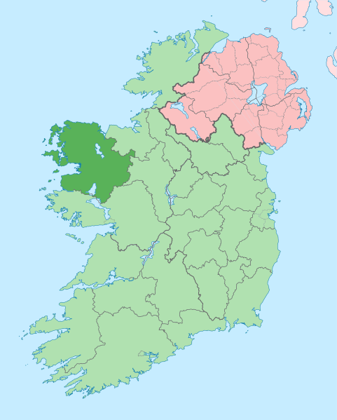
Fitxer:Island of Ireland location map Mayo.svg
Aparença

Mida d'aquesta previsualització PNG del fitxer SVG: 481 × 599 píxels. Altres resolucions: 192 × 240 píxels | 385 × 480 píxels | 616 × 768 píxels | 822 × 1.024 píxels | 1.643 × 2.048 píxels | 1.450 × 1.807 píxels.
Fitxer original (fitxer SVG, nominalment 1.450 × 1.807 píxels, mida del fitxer: 642 Ko)
Historial del fitxer
Cliqueu una data/hora per veure el fitxer tal com era aleshores.
| Data/hora | Miniatura | Dimensions | Usuari/a | Comentari | |
|---|---|---|---|---|---|
| actual | 15:01, 28 juny 2020 |  | 1.450 × 1.807 (642 Ko) | Chipmunkdavis | Per the Local Government Reform Act 2014, joining both Tipperarys and both Waterfords (and removing Limerick City code). Colouring in islands, cleaning up and grouping code to remove stray objects and show Galway and Lough Ree. |
| 01:58, 19 jul 2010 |  | 1.450 × 1.807 (815 Ko) | Mabuska | {{Information |Description={{en|The island of Ireland, showing international border between Northern Ireland and Republic of Ireland, traditional provinces, traditional counties, and local authority areas in the Republic of Ireland and Northern Ireland.}} |
Ús del fitxer
Les 28 pàgines següents utilitzen aquest fitxer:
- An Caiseal
- Ballina
- Bangor Erris
- Bun an Churraigh
- Béal Deirg
- Béal an Mhuirthead
- Castlebar
- Ceathrú Thaidhg
- Comtat de Mayo
- Cong
- Crossmolina
- Doohoma
- Dumha Éige
- Dún Ibhir
- Eachléim
- Gleann an Ghad
- Gob an Choire
- Gweesalia
- Illa de Clare
- Iorras
- Kilcummin
- Killala
- Ros Dumhach
- Sáile
- Tuar Mhic Éadaigh
- Turlough
- Westport (Mayo)
- Plantilla:Comtat Mayo
Ús global del fitxer
Utilització d'aquest fitxer en altres wikis:
- Utilització a ang.wikipedia.org
- Utilització a ar.wikipedia.org
- Utilització a arz.wikipedia.org
- Utilització a ast.wikipedia.org
- Utilització a bg.wikipedia.org
- Utilització a ceb.wikipedia.org
- Utilització a cs.wikipedia.org
- Utilització a de.wikivoyage.org
- Utilització a en.wikipedia.org
- County Mayo
- Rockfleet Castle
- Lough Conn
- Collanmore Island
- Achill Sound
- Michael Davitt Bridge
- Caher Island
- Partry
- Lecanvey
- Ballintubber
- Bekan, County Mayo
- Bellavary
- Belderrig
- Castlehill, County Mayo
- Cregganbaun
- Keel, County Mayo
- Strade
- Cross, County Mayo
- Inishbiggle
- Black River (Ireland)
- Illanmaster
- Glenhest
- Charlestown-Bellahy
- Bohalis
- Gweesalia
- Meelick, County Mayo
- Mayo Senior Football Championship
- Mayo Senior Hurling Championship
- Breaffy
- Template:Mayo-geo-stub
- Lough Carra
- Shammer
- Shanaghy
- Drummin, County Mayo
- Errew
Vegeu més usos globals d'aquest fitxer.

