
Fitxer:Lincoln Sea map.png
Mida d'aquesta previsualització: 657 × 600 píxels. Altres resolucions: 263 × 240 píxels | 526 × 480 píxels | 1.000 × 913 píxels.
Fitxer original (1.000 × 913 píxels, mida del fitxer: 302 Ko, tipus MIME: image/png)
| Aquest fitxer i la informació mostrada a continuació provenen del dipòsit multimèdia lliure Wikimedia Commons. |

|
Aquesta imatge (de tipus locator map) s'hauria de tornar a crear utilitzant gràfics vectorials com ara un fitxer SVG. Això té diversos avantatges; en trobareu més informació a Commons:Media for cleanup. Si ja disposeu d'una versió d'aquesta imatge en format SVG, us preguem que la pengeu; després, reemplaceu aquesta plantilla amb la plantilla {{Vector version available|nom nou de la imatge.svg}} en aquesta imatge.
|
| Posició de la càmera | | Aquesta i altres imatges properes a: OpenStreetMap |
|---|
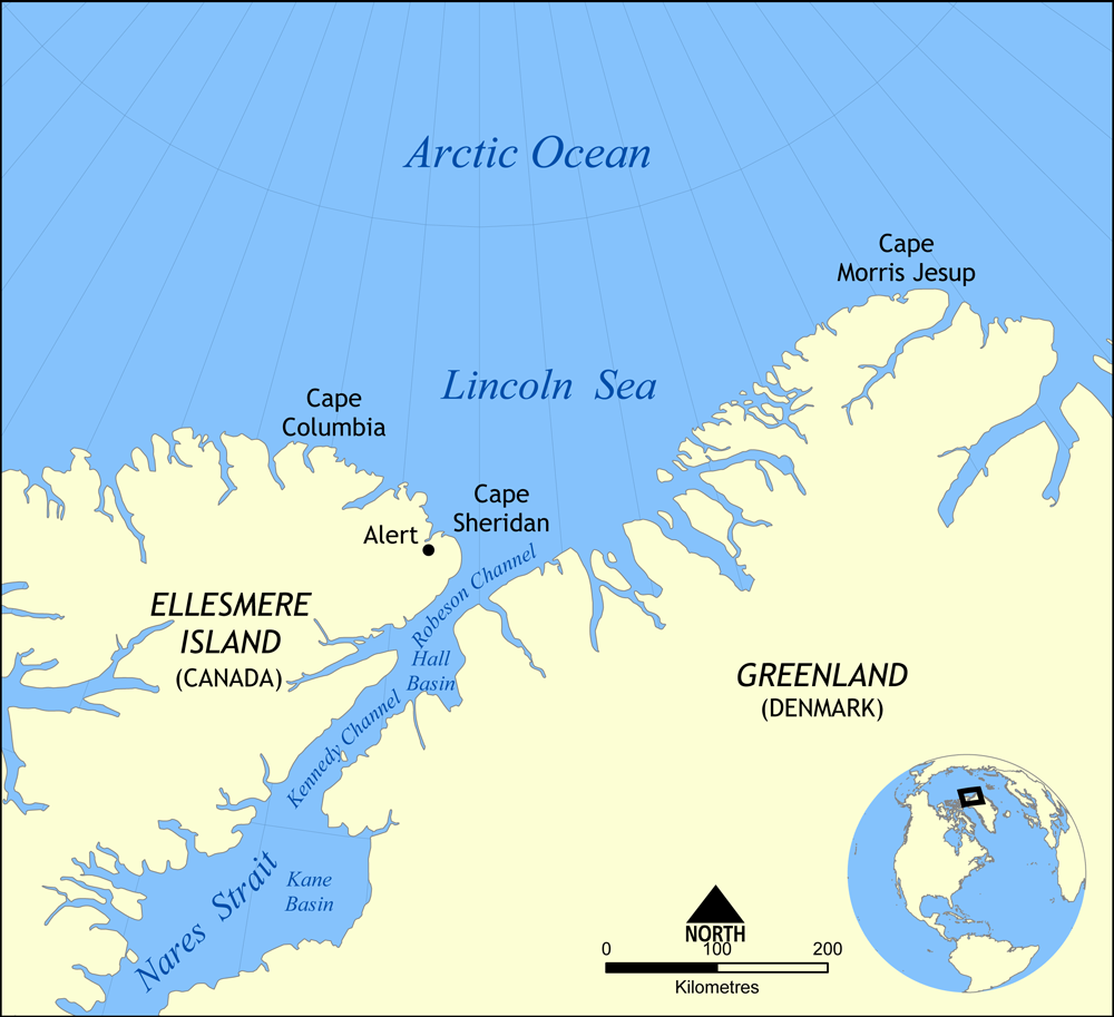
Map showing the location of the Lincoln Sea, part of the Arctic Ocean. Also shows Cape Columbia and Cape Morris Jesup.
Created by NormanEinstein, May 30, 2006.
Jo, el titular dels drets d'autor d'aquest treball, el public sota la següent llicència:

|
S'autoritza la còpia, la distribució i la modificació d'aquest document sota els termes de la llicència de documentació lliure GNU versió 1.2 o qualsevol altra versió posterior que publiqui la Free Software Foundation; sense seccions invariants, ni textos de portada, ni textos de contraportada. S'inclou una còpia d'aquesta llicència en la secció titulada GNU Free Documentation License. |
| Aquest fitxer està subjecte a la llicència de Creative Commons Reconeixement i Compartir Igual 3.0 No adaptada. | ||
| ||
| Aquest avís de llicència s'ha afegit a aquest fitxer d'acord amb l'actualització de la llicència GFDL. |
Historial del fitxer
Cliqueu una data/hora per veure el fitxer tal com era aleshores.
| Data/hora | Miniatura | Dimensions | Usuari/a | Comentari | |
|---|---|---|---|---|---|
| actual | 18:01, 7 ago 2007 | | 1.000 × 913 (302 Ko) | NormanEinstein | Updated map. Slightly larger size. |
| 23:14, 6 ago 2007 |  | 657 × 600 (185 Ko) | Eivindgh | ||
| 23:13, 6 ago 2007 |  | 657 × 600 (185 Ko) | Eivindgh | ||
| 16:02, 30 maig 2006 |  | 996 × 909 (104 Ko) | NormanEinstein | {{Information Map showing the location of the Lincoln Sea, part of the Arctic Ocean. Also shows Cape Columbia and Cape Morris Jesup. Created by NormanEinstein, May 30, 2006. {{GFDL-self}} Category:Maps of seas |
Ús del fitxer
Les 5 pàgines següents utilitzen aquest fitxer:
Ús global del fitxer
Utilització d'aquest fitxer en altres wikis:
- Utilització a af.wikipedia.org
- Utilització a ar.wikipedia.org
- Utilització a ast.wikipedia.org
- Utilització a azb.wikipedia.org
- Utilització a az.wikipedia.org
- Utilització a bg.wikipedia.org
- Utilització a bn.wikipedia.org
- Utilització a bs.wikipedia.org
- Utilització a ceb.wikipedia.org
- Utilització a cs.wikipedia.org
- Utilització a da.wikipedia.org
- Utilització a de.wikipedia.org
- Utilització a en.wikipedia.org
- Utilització a es.wikipedia.org
- Utilització a et.wikipedia.org
- Utilització a eu.wikipedia.org
- Utilització a fa.wikipedia.org
- Utilització a fi.wikipedia.org
- Utilització a fr.wikipedia.org
- Utilització a he.wikipedia.org
- Utilització a hu.wiktionary.org
- Utilització a hy.wikipedia.org
Vegeu més usos globals d'aquest fitxer.