
Fitxer:Chamba Kangra Bilaspur Mandi Kulu 1911.jpeg
Fitxer original (744 × 873 píxels, mida del fitxer: 130 Ko, tipus MIME: image/jpeg)
| Aquest fitxer i la informació mostrada a continuació provenen del dipòsit multimèdia lliure Wikimedia Commons. |
Resum
| Descripció |
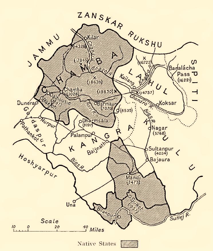
English: Map of some Indian princely states in the "Shimla Hill/Punjab Hill Agency" amongst them Chamba, Kangra, Bilaspur (= Khalur), Mandi, Kulu, 1911
Deutsch: Karte einiger kleinerer indischer Fürstenstaaten in der "Shimla Hill/Punjab Hill Agency" unter anderem Chamba, Kangra, Bilaspur(= Khalur), Mandi, Kulu, 1911 |
| Data | |
| Font | Provincial Geographies of India , Vol. III |
| Autor | Holland, Thomas H. (Thomas Henry), Sir |


Llicència
|
Aquest material està en domini públic als Estats Units i als altres països on el dret d'autor s'estén per 70 anys (o menys) després de la mort de l'autor.
| |
| Aquest fitxer està identificat com a lliure de restriccions conegudes sota la llei de drets d'autor, inclosos els drets veïns. | |
Historial del fitxer
Cliqueu una data/hora per veure el fitxer tal com era aleshores.
| Data/hora | Miniatura | Dimensions | Usuari/a | Comentari | |
|---|---|---|---|---|---|
| actual | 04:03, 29 juny 2014 | | 744 × 873 (130 Ko) | Xufanc | Sepia tone |
| 17:30, 18 gen 2010 |  | 744 × 873 (123 Ko) | Zenwort | {{Information |Description={{en|1=Map of some Indian princely states in the "Shimla Hill/Punjab Hill Agency" amongst them Chamba, Kangra, Bilaspur (= Khalur), Mandi, Kulu, 1911}} {{de|1=Karte einiger kleinerer indischer Fürstenstaaten in der "Shimla Hill |
Ús del fitxer
Ús global del fitxer
Utilització d'aquest fitxer en altres wikis:
- Utilització a br.wikipedia.org
- Utilització a de.wikipedia.org
- Utilització a en.wikipedia.org
- Utilització a hi.wikipedia.org
- Utilització a it.wikipedia.org
- Utilització a or.wikipedia.org
- Utilització a pnb.wikipedia.org
- Utilització a ru.wikipedia.org
- Utilització a simple.wikipedia.org
- Utilització a ta.wikipedia.org
- Utilització a ur.wikipedia.org
- Utilització a www.wikidata.org