
Fitxer:Croatian Prevlaka in occupation by Montenegro and Serbia.jpg
No hi ha cap versió amb una resolució més gran.
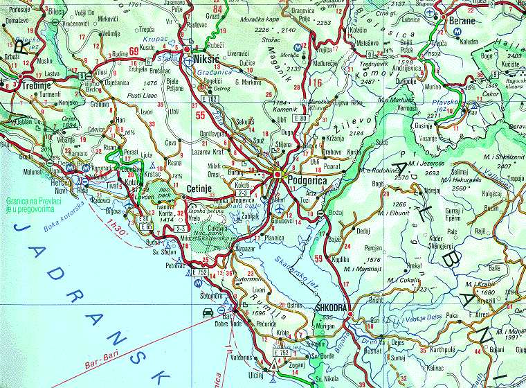
Croatian_Prevlaka_in_occupation_by_Montenegro_and_Serbia.jpg (760 × 560 píxels, mida del fitxer: 118 Ko, tipus MIME: image/jpeg)
| Aquest fitxer i la informació mostrada a continuació provenen del dipòsit multimèdia lliure Wikimedia Commons. |
| Descripció | Map of Montenegrin Littoral Region and Boka kotorska in the time of occupation of Croatian Prevlaka Region which is the remaining part of Boka kotorska that belongs to Croatia. | |||
| Data | 1991-2002 (occupation ended 1992-10-20 at 20:30) (UNMIK mission ended 2002-12-20). | |||
| Font | Ministry of Foreign Affairs of the State Union Serbia and Montenegro (before that MFA of Federal Republic of Yugoslavia | |||
| Autor | Serbian Official Cartography (Public Service at the time). | |||
| Permís (Com reutilitzar aquest fitxer) |
|
|||
| Altres versions | Geographical version. |

Historial del fitxer
Cliqueu una data/hora per veure el fitxer tal com era aleshores.
| Data/hora | Miniatura | Dimensions | Usuari/a | Comentari | |
|---|---|---|---|---|---|
| actual | 04:05, 16 feb 2008 | | 760 × 560 (118 Ko) | Imbris~commonswiki | {{Information |Description=Map of Montenegrin ''Littoral Region'' and ''Boka kotorska'' in the time of occupation of Croatian hr:Prevlaka Region which is the remaining part of Boka kotorska that belongs to Croatia. |Source=[http://www.mfa.gov.yu/Fact |
Ús del fitxer
La pàgina següent utilitza aquest fitxer:
Ús global del fitxer
Utilització d'aquest fitxer en altres wikis:
- Utilització a ckb.wikipedia.org
- Utilització a de.wikipedia.org
- Utilització a en.wikipedia.org
- Utilització a fa.wikipedia.org
- Utilització a hr.wikipedia.org
- Utilització a id.wikipedia.org
- Utilització a mzn.wikipedia.org
- Utilització a nl.wikipedia.org
- Utilització a ru.wikipedia.org
- Utilització a sh.wikipedia.org
- Utilització a sq.wikipedia.org
- Utilització a www.wikidata.org
- Utilització a zh.wikipedia.org