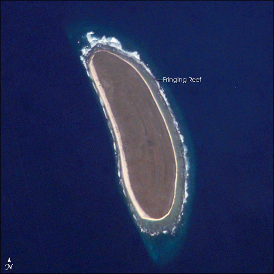
Fitxer:Howland island nasa.jpg
Howland_island_nasa.jpg (540 × 540 píxels, mida del fitxer: 51 Ko, tipus MIME: image/jpeg)
Historial del fitxer
Cliqueu una data/hora per veure el fitxer tal com era aleshores.
| Data/hora | Miniatura | Dimensions | Usuari/a | Comentari | |
|---|---|---|---|---|---|
| actual | 14:48, 19 març 2006 |  | 540 × 540 (51 Ko) | Maksim | La bildo estas kopiita de wikipedia:en. La originala priskribo estas: Howland Island, Pacific Ocean image description [http://earthobservatory.nasa.gov/Newsroom/NewImages/images.php3?img_id=16779 here] larger version [http://earthobservatory.nasa.gov/N |
Ús del fitxer
La pàgina següent utilitza aquest fitxer:
Ús global del fitxer
Utilització d'aquest fitxer en altres wikis:
- Utilització a af.wikipedia.org
- Utilització a ar.wikipedia.org
- Utilització a arz.wikipedia.org
- Utilització a be-tarask.wikipedia.org
- Utilització a be.wikipedia.org
- Utilització a bg.wikipedia.org
- Utilització a ceb.wikipedia.org
- Utilització a cs.wikipedia.org
- Utilització a da.wikipedia.org
- Utilització a de.wikipedia.org
- Utilització a el.wikipedia.org
- Utilització a en.wikipedia.org
- Utilització a en.wikiversity.org
- Utilització a en.wikivoyage.org
- Utilització a eo.wikipedia.org
- Utilització a es.wikipedia.org
- Utilització a et.wikipedia.org
- Utilització a eu.wikipedia.org
- Utilització a fa.wikipedia.org
- Utilització a fr.wikipedia.org
- Utilització a gl.wikipedia.org
- Utilització a he.wikipedia.org
- Utilització a hr.wikipedia.org
- Utilització a hy.wikipedia.org
- Utilització a id.wikipedia.org
- Utilització a io.wikipedia.org
- Utilització a is.wikipedia.org
- Utilització a it.wikipedia.org
- Utilització a ja.wikipedia.org
- Utilització a ka.wikipedia.org
- Utilització a ko.wikipedia.org
- Utilització a la.wikipedia.org
- Utilització a lt.wikipedia.org
- Utilització a mk.wikipedia.org
- Utilització a ml.wikipedia.org
- Utilització a nl.wikipedia.org
- Utilització a pl.wikipedia.org
- Utilització a pnb.wikipedia.org
- Utilització a ro.wikipedia.org
- Utilització a scn.wikipedia.org
Vegeu més usos globals d'aquest fitxer.


