
Fitxer:IndianTerritory.jpg
Mida d'aquesta previsualització: 565 × 599 píxels. Altres resolucions: 226 × 240 píxels | 452 × 480 píxels | 1.000 × 1.061 píxels.
Fitxer original (1.000 × 1.061 píxels, mida del fitxer: 233 Ko, tipus MIME: image/jpeg)
| Aquest fitxer i la informació mostrada a continuació provenen del dipòsit multimèdia lliure Wikimedia Commons. |
Resum
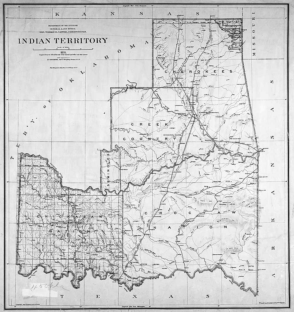
| Descripció |
English: Map of Indian territory in Oklahoma in 1891. |
| Data | |
| Font |
National Archives Federal Indian Policy, direct image here. |
| Autor | General Land Office, U.S. Department of the Interior |

|
Aquesta imatge (de tipus old map) s'hauria de tornar a crear utilitzant gràfics vectorials com ara un fitxer SVG. Això té diversos avantatges; en trobareu més informació a Commons:Media for cleanup. Si ja disposeu d'una versió d'aquesta imatge en format SVG, us preguem que la pengeu; després, reemplaceu aquesta plantilla amb la plantilla {{Vector version available|nom nou de la imatge.svg}} en aquesta imatge.
|


Llicència
| This image or media file contains material based on a work of a United States Department of the Interior employee, created as part of that person's official duties. As a work of the U.S. federal government, such work is in the public domain in the United States. See the Department of the Interior copyright policy for more information. |  |
This media is available in the holdings of the National Archives and Records Administration, cataloged under the National Archives Identifier (NAID) missing.
This tag does not indicate the copyright status of the attached work. A normal copyright tag is still required. See Commons:Licensing.
|
Registre original de càrregues
La pàgina de descripció original era aquí. Els noms d'usuari a continuació es refereixen a en.wikipedia.
- 2004-04-17 03:33 RickK 500×531×8 (79801 bytes) From http://www.archives.gov/digital_classroom/lessons/federal_indian_policy/federal_indian_policy.html, federal government site, public domain
- 2004-04-17 03:32 RickK 500×531×8 (79801 bytes) From http://www.archives.gov/digital_classroom/lessons/federal_indian_policy/federal_indian_policy.html, federal government site, public domain
Historial del fitxer
Cliqueu una data/hora per veure el fitxer tal com era aleshores.
| Data/hora | Miniatura | Dimensions | Usuari/a | Comentari | |
|---|---|---|---|---|---|
| actual | 18:46, 5 juny 2011 | | 1.000 × 1.061 (233 Ko) | Clindberg | Larger version from source |
| 18:26, 5 abr 2008 |  | 500 × 531 (78 Ko) | File Upload Bot (Magnus Manske) | {{BotMoveToCommons|en.wikipedia}} {{Information |Description={{en|From http://www.archives.gov/digital_classroom/lessons/federal_indian_policy/federal_indian_policy.html, federal government site, public domain [[:en:Category:Historical maps of the Unit |
Ús del fitxer
La pàgina següent utilitza aquest fitxer:
Ús global del fitxer
Utilització d'aquest fitxer en altres wikis:
- Utilització a de.wikipedia.org
- Utilització a en.wikipedia.org
- Utilització a es.wikipedia.org
- Utilització a it.wikipedia.org
- Utilització a kk.wikipedia.org
- Utilització a mk.wikipedia.org
- Utilització a pl.wikipedia.org
- Utilització a pt.wikipedia.org
- Utilització a ru.wikipedia.org
- Utilització a sr.wikipedia.org
- Utilització a uk.wikipedia.org