
Fitxer:Iyo-Aoshima Island Aerial photograph.jpg
Mida d'aquesta previsualització: 800 × 580 píxels. Altres resolucions: 320 × 232 píxels | 640 × 464 píxels | 1.024 × 743 píxels | 1.280 × 929 píxels | 2.531 × 1.836 píxels.
Fitxer original (2.531 × 1.836 píxels, mida del fitxer: 1,09 Mo, tipus MIME: image/jpeg)
| Aquest fitxer i la informació mostrada a continuació provenen del dipòsit multimèdia lliure Wikimedia Commons. |
Resum
| Descripció |
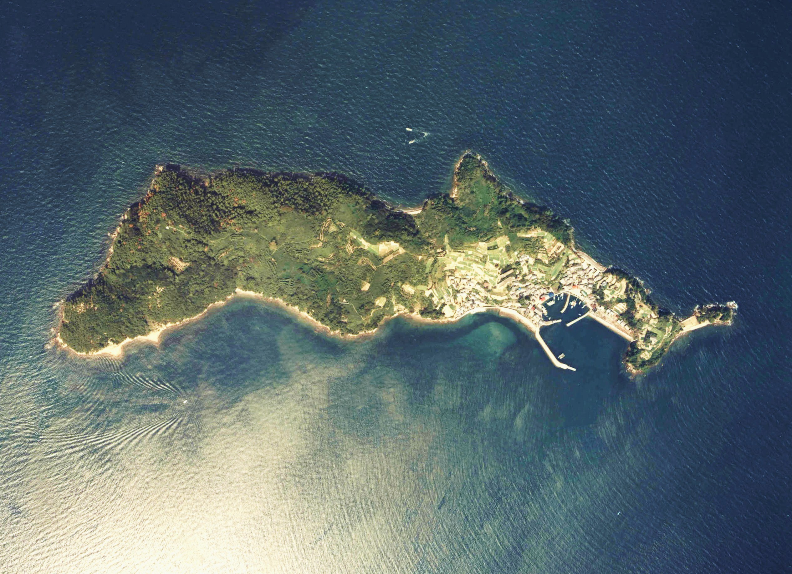
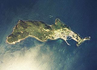
English: Iyo-Aoshima Island Aerial photograph
日本語: 伊予青島付近の空中写真(愛媛県大洲市)。ccg-81-3_c48_2を利用。 |
| Data | |
| Font | 国土情報ウェブマッピングシステム |
| Autor | 国土交通省 |
Llicència

|
El titular dels drets d'autor d'aquest arxiu, the Ministry of Land, Infrastructure, Transport and Tourism of Japan, permet que qualsevol pugui usar-lo per a qualsevol propòsit, sempre que el titular dels drets d'autor sigui reconegut correctament. La redistribució, les obres derivades, l'ús comercial, i qualsevol altre ús està permès. |
Reconeixement:
Copyright © National Land Image Information (Color Aerial Photographs), Ministry of Land, Infrastructure, Transport and Tourism
|
 |
This image is copyrighted by the Ministry of Land, Infrastructure, Transport and Tourism of Japan. For terms of use, see the stipulation to use of National Land Information (in Japanese) and message from MLIT (in Japanese and English). When you display this image on an article, include the following phrase in the description: "Made based on National Land Image Information (Color Aerial Photographs), Ministry of Land, Infrastructure, Transport and Tourism".
|
Historial del fitxer
Cliqueu una data/hora per veure el fitxer tal com era aleshores.
| Data/hora | Miniatura | Dimensions | Usuari/a | Comentari | |
|---|---|---|---|---|---|
| actual | 08:43, 12 nov 2012 | | 2.531 × 1.836 (1,09 Mo) | さかおり | {{Information |Description ={{en|1=Iyo-Aoshima Island Aerial photograph}} {{ja|1=伊予青島付近の空中写真(愛媛県大洲市)。ccg-81-3_c48_2を利用。}} |Source =国土情報ウェブマッピングシステム |Author ... |
Ús del fitxer
La pàgina següent utilitza aquest fitxer:
Ús global del fitxer
Utilització d'aquest fitxer en altres wikis:
- Utilització a az.wikipedia.org
- Utilització a de.wikipedia.org
- Utilització a en.wikipedia.org
- Utilització a et.wikipedia.org
- Utilització a fr.wikipedia.org
- Utilització a id.wikipedia.org
- Utilització a it.wikipedia.org
- Utilització a ja.wikipedia.org
- Utilització a ko.wikipedia.org
- Utilització a pt.wikipedia.org
- Utilització a ru.wikipedia.org
- Utilització a sv.wikipedia.org
- Utilització a tr.wikipedia.org
- Utilització a vi.wikipedia.org
- Utilització a www.wikidata.org