
Fitxer:Los Angeles Basin from Mulholland Pan.jpg
Mida d'aquesta previsualització: 800 × 320 píxels. Altres resolucions: 320 × 128 píxels | 640 × 256 píxels | 1.024 × 409 píxels | 1.280 × 511 píxels | 3.845 × 1.536 píxels.
Fitxer original (3.845 × 1.536 píxels, mida del fitxer: 817 Ko, tipus MIME: image/jpeg)
| Aquest fitxer i la informació mostrada a continuació provenen del dipòsit multimèdia lliure Wikimedia Commons. |
Resum
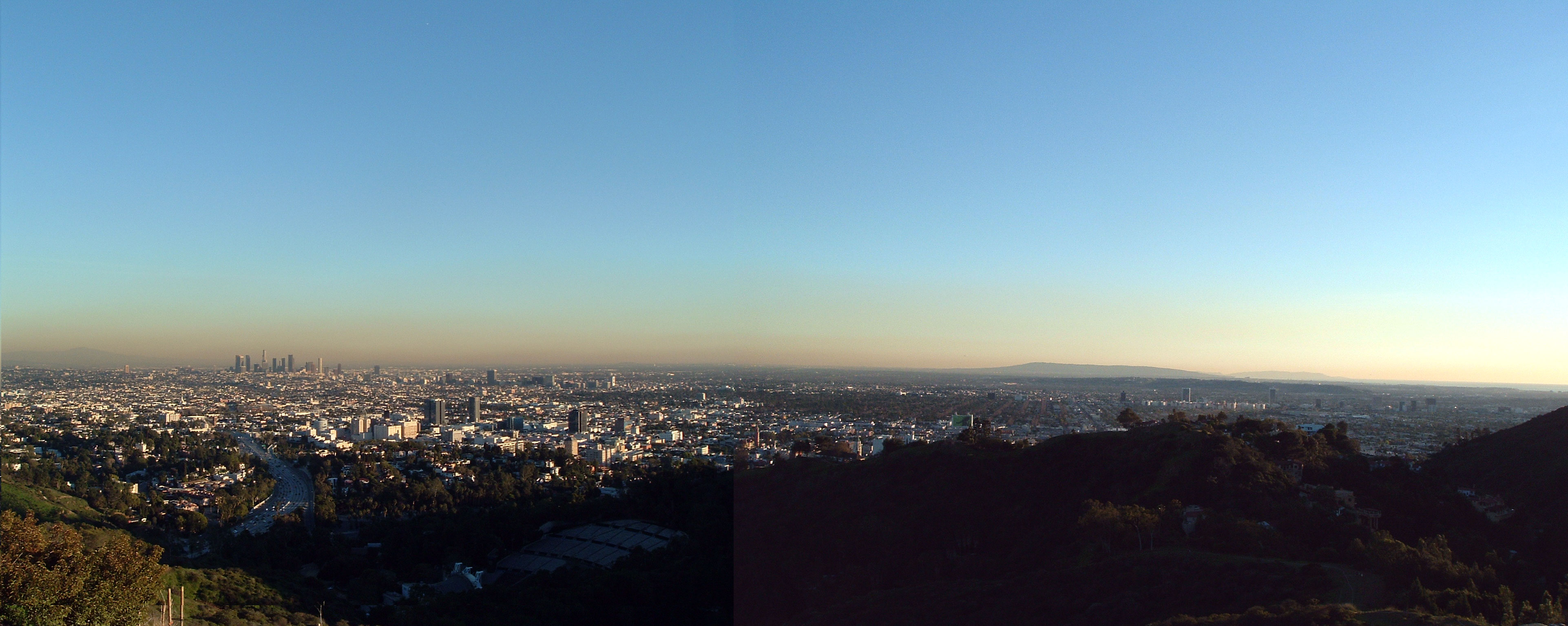
English: Panoramic shot of the Los Angeles Basin from Mulholland Drive.
- The Pacific Ocean is to the far right. The downtown Los Angeles skyline is the tallest of the buildings to the left (there are many hidden buildings behind other buildings; the skyline looks small but isn't really). The Hollywood Bowl is to the bottom.
- Starting in the center-right part of the photo and going farther away, the hill/mountain ranges, in order from closest to viewpoint to farthest, are Baldwin Hills, Palos Verdes Peninsula, and Santa Catalina Island, 20 miles offshore.
- The entire basin is urbanized except for small farming spots east of Long Beach and into the Inland Empire, 20 miles east of downtown Los Angeles, and many random undeveloped parcels, waiting to be developed, in otherwise urbanized areas.
- Credits
-
- Photos taken and edited by Lan56 around 4:00 PM PST.

|
S'autoritza la còpia, la distribució i la modificació d'aquest document sota els termes de la llicència de documentació lliure GNU versió 1.2 o qualsevol altra versió posterior que publiqui la Free Software Foundation; sense seccions invariants, ni textos de portada, ni textos de contraportada. S'inclou una còpia d'aquesta llicència en la secció titulada GNU Free Documentation License. |
| Aquest fitxer està subjecte a la llicència de Creative Commons Reconeixement i Compartir Igual 3.0 No adaptada. | ||
| ||
| Aquest avís de llicència s'ha afegit a aquest fitxer d'acord amb l'actualització de la llicència GFDL. |
Historial del fitxer
Cliqueu una data/hora per veure el fitxer tal com era aleshores.
| Data/hora | Miniatura | Dimensions | Usuari/a | Comentari | |
|---|---|---|---|---|---|
| actual | 05:38, 26 oct 2008 | 3.845 × 1.536 (817 Ko) | Dschwen | Reverted to version as of 01:22, 31 July 2005 | |
| 23:04, 25 oct 2008 | 3.845 × 1.536 (794 Ko) | Evian Pepper | Enhanced colour | ||
| 03:22, 31 jul 2005 | 3.845 × 1.536 (817 Ko) | Cantus | fix brightness of second image // compress 60% JPEG | ||
| 03:52, 15 maig 2005 | 3.845 × 1.536 (2,51 Mo) | Lan56~commonswiki | Panoramic shot of the Los Angeles Basin from Mulholland Drive. The Pacific Ocean is to the far right. The downtown Los Angeles skyline is the tallest of the buildings to the left (there are many hidden buildings behind other buildings; the skyline looks s |
Ús del fitxer
La pàgina següent utilitza aquest fitxer:
Ús global del fitxer
Utilització d'aquest fitxer en altres wikis:
- Utilització a ar.wikipedia.org
- Utilització a ast.wikipedia.org
- Utilització a en.wikipedia.org
- Utilització a es.wikipedia.org
- Utilització a fr.wikipedia.org
- Utilització a ja.wikipedia.org
- Utilització a nl.wikipedia.org
- Utilització a pl.wikipedia.org
- Utilització a sv.wikipedia.org
- Utilització a vi.wikipedia.org
- Utilització a zh.wikipedia.org