
Fitxer:Map of Death Valley National Park.jpg
Mida d'aquesta previsualització: 465 × 599 píxels. Altres resolucions: 186 × 240 píxels | 373 × 480 píxels | 596 × 768 píxels | 795 × 1.024 píxels | 1.590 × 2.048 píxels | 4.057 × 5.225 píxels.
Fitxer original (4.057 × 5.225 píxels, mida del fitxer: 2,76 Mo, tipus MIME: image/jpeg)
| Aquest fitxer i la informació mostrada a continuació provenen del dipòsit multimèdia lliure Wikimedia Commons. |
| Descripció | |
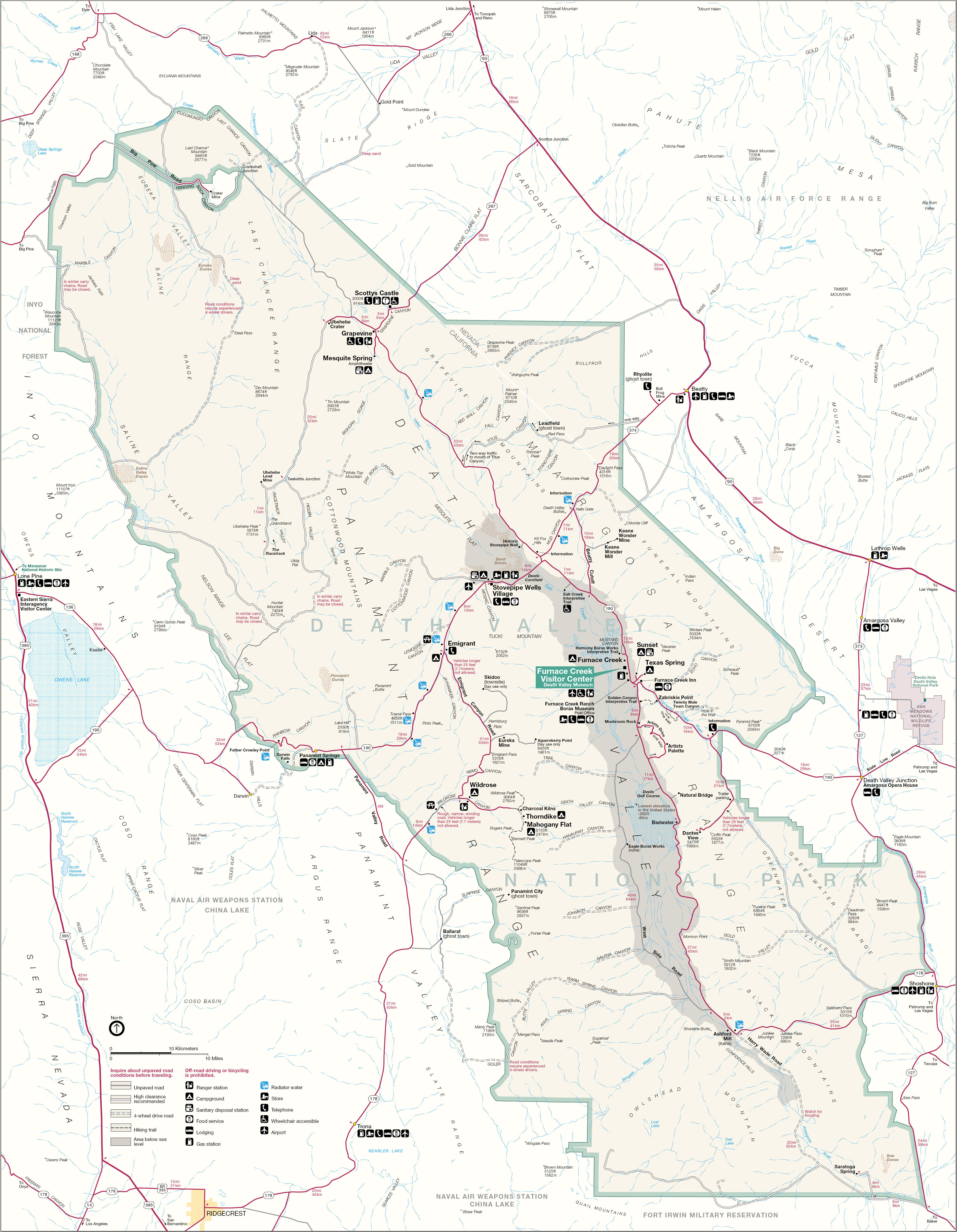
| Font | http://www.nps.gov |
| Autor | Death Valley National Park |
| Permís (Com reutilitzar aquest fitxer) |
PD-USGov-NPS |
| This image or media file contains material based on a work of a National Park Service employee, created as part of that person's official duties. As a work of the U.S. federal government, such work is in the public domain in the United States. See the NPS website and NPS copyright policy for more information. |
Historial del fitxer
Cliqueu una data/hora per veure el fitxer tal com era aleshores.
| Data/hora | Miniatura | Dimensions | Usuari/a | Comentari | |
|---|---|---|---|---|---|
| actual | 07:05, 25 ago 2006 | | 4.057 × 5.225 (2,76 Mo) | Huebi~commonswiki | {{Information |Description=Death Valley National Park |Source=http://www.nps.gov |Date= |Author= |Permission= |other_versions= }} {{PD-USGov-NPS}} category:Death Valley National Park |
Ús del fitxer
La pàgina següent utilitza aquest fitxer:
Ús global del fitxer
Utilització d'aquest fitxer en altres wikis:
- Utilització a de.wikipedia.org
- Utilització a es.wikipedia.org
- Utilització a nl.wikipedia.org