Fitxer:Plan der Kgl. Freistadt und Festung Temesvár (aus PREYER 1853).jpg

El contingut de la pàgina no s'admet en altres llengües.
De la Viquipèdia, l'enciclopèdia lliure

Fitxer original(5.913 × 4.990 píxels, mida del fitxer: 5,53 Mo, tipus MIME: image/jpeg)

Descripció a Commons
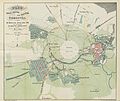
Plan der Kgl. Freistadt und Festung Temesvár ...
Títol
Plan der Kgl. Freistadt und Festung Temesvár ...
Data 1853
date QS:P571,+1853-00-00T00:00:00Z/9
Número d'inventari
British Library HMNTS 10215.g.13.
Origen/Fotògraf

Image extracted from page 197 of Monographie der königlichen Freistadt Temesvár …, by PREYER, Johann N.. Original held and digitised by the British Library. Copied from Flickr.

Note: The colours, contrast and appearance of these illustrations are unlikely to be true to life. They are derived from scanned images that have been enhanced for machine interpretation and have been altered from their originals.

This file is from the Mechanical Curator collection, a set of over 1 million images scanned from out-of-copyright books and released to Flickr Commons by the British Library.

 View image on Flickr   View all images from book 

 View catalogue entry for book

العربية‎ | беларуская (тарашкевіца)‎ | English | français | galego | македонски | suomi | +/−

Permís
(Com reutilitzar aquest fitxer)
Public domain

Aquest material està en domini públic als Estats Units i als altres països on el dret d'autor s'estén per 70 anys (o menys) després de la mort de l'autor.


Aquesta obra es troba en el domini públic als Estats Units d'Amèrica per haver estat publicada abans de l'1 de gener de 1929.

Historial del fitxer

Cliqueu una data/hora per veure el fitxer tal com era aleshores.

Data/horaMiniaturaDimensionsUsuari/aComentari
actual11:41, 27 març 2014Miniatura per a la versió del 11:41, 27 març 20145.913 × 4.990 (5,53 Mo)MetilsteinerUser created page with UploadWizard

La pàgina següent utilitza aquest fitxer:

Ús global del fitxer

Utilització d'aquest fitxer en altres wikis: