
Fitxer:Rottumeroog Rottumerplaat 6.53663E 53.54001N.jpg

Mida d'aquesta previsualització: 800 × 599 píxels. Altres resolucions: 320 × 240 píxels | 640 × 479 píxels | 1.024 × 766 píxels | 1.280 × 958 píxels.
Fitxer original (1.280 × 958 píxels, mida del fitxer: 444 Ko, tipus MIME: image/jpeg)
| Aquest fitxer i la informació mostrada a continuació provenen del dipòsit multimèdia lliure Wikimedia Commons. |
| Descripció |
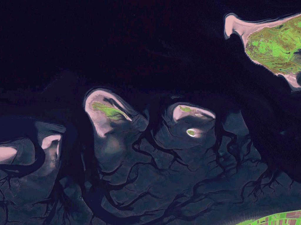
English: Some West Frisian Islands (Netherlands) and some East Frisian Islands (Germany), from left to right: part of Schiermonnikoog, Simonszand, Rottumerplaat, Rottumeroog (north) with Zuiderduintjes (south) and part of Borkum. |
|||
| Data | abans 2005 | |||
| Font |
English: NASA World Wind screenshot |
|||
| Autor | – (NASA World Wind) | |||
| Permís (Com reutilitzar aquest fitxer) |
|

| Anotacions | Aquesta imatge té anotacions: Vegeu-les a Commons |
Historial del fitxer
Cliqueu una data/hora per veure el fitxer tal com era aleshores.
| Data/hora | Miniatura | Dimensions | Usuari/a | Comentari | |
|---|---|---|---|---|---|
| actual | 21:06, 13 oct 2013 | | 1.280 × 958 (444 Ko) | Jahoe | stretched contrast |
| 15:53, 15 maig 2005 |  | 1.280 × 958 (59 Ko) | Rex | NASA World Wind screenshot. {{PD-USGov-NASA}} Category:Maps of The Netherlands |
Ús del fitxer
Les 2 pàgines següents utilitzen aquest fitxer:
Ús global del fitxer
Utilització d'aquest fitxer en altres wikis:
- Utilització a arz.wikipedia.org
- Utilització a br.wikipedia.org
- Utilització a ceb.wikipedia.org
- Utilització a de.wikipedia.org
- Utilització a en.wikipedia.org
- Utilització a eo.wikipedia.org
- Utilització a es.wikipedia.org
- Utilització a frr.wikipedia.org
- Utilització a fr.wikipedia.org
- Utilització a fy.wikipedia.org
- Utilització a nds-nl.wikipedia.org
- Utilització a nds.wikipedia.org
- Utilització a nl.wikipedia.org
- Utilització a nn.wikipedia.org
- Utilització a no.wikipedia.org
- Utilització a ru.wikipedia.org
- Utilització a stq.wikipedia.org
- Utilització a www.wikidata.org