
Fitxer:TMD trail map.png

Mida d'aquesta previsualització: 640 × 600 píxels. Altres resolucions: 256 × 240 píxels | 999 × 936 píxels.
Fitxer original (999 × 936 píxels, mida del fitxer: 234 Ko, tipus MIME: image/png)
| Aquest fitxer i la informació mostrada a continuació provenen del dipòsit multimèdia lliure Wikimedia Commons. |
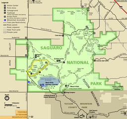
| Descripció |
English: Map of the Tucson Mountain District of Saguaro National Park in the U.S. state of Arizona |
|||
| Data | (date of upload); unknown date of creation of the original | |||
| Font | official park map | |||
| Autor | National Park Service; converted from PDF to PNG format by User:Finetooth using GNU Image Manipulation Program (GIMP) software | |||
| Permís (Com reutilitzar aquest fitxer) |
|
Historial del fitxer
Cliqueu una data/hora per veure el fitxer tal com era aleshores.
| Data/hora | Miniatura | Dimensions | Usuari/a | Comentari | |
|---|---|---|---|---|---|
| actual | 04:22, 15 juny 2017 | | 999 × 936 (234 Ko) | Finetooth | Removed clutter in the form of numbers unexplained in the map legend. |
| 01:24, 15 juny 2017 |  | 999 × 936 (314 Ko) | Finetooth | {{Information |Description ={{en|1=Map of the Tucson Mountain District of Saguaro National Park in the U.S. state of Arizona}} |Source =[https://www.nps.gov/sagu/planyourvisit/upload/sentinel_fall10_tmd.pdf official park map] |Author... |
Ús del fitxer
La pàgina següent utilitza aquest fitxer:
Ús global del fitxer
Utilització d'aquest fitxer en altres wikis:
- Utilització a en.wikipedia.org
- Utilització a eu.wikipedia.org
- Utilització a he.wikipedia.org