
Fitxer:Utrecht position.svg

Mida d'aquesta previsualització PNG del fitxer SVG: 200 × 236 píxels. Altres resolucions: 203 × 240 píxels | 407 × 480 píxels | 651 × 768 píxels | 868 × 1.024 píxels | 1.736 × 2.048 píxels.
Fitxer original (fitxer SVG, nominalment 200 × 236 píxels, mida del fitxer: 157 Ko)
| Aquest fitxer i la informació mostrada a continuació provenen del dipòsit multimèdia lliure Wikimedia Commons. |
Resum
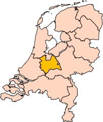
| Descripció | Location of the province of Utrecht in the Netherlands. |
| Data | |
| Font | Own work, based on freely available GIS data |
| Autor | User:Mtcv |
| Permís (Com reutilitzar aquest fitxer) |
Data: attribution required; my work: PD |
| Altres versions | I attempted to make an svg version of Image:Utrecht-Position.png (with less simplified boundaries) |
Clickable version

Llicència

|
El titular dels drets d'autor d'aquest arxiu, Centraal Bureau voor de Statistiek, permet que qualsevol pugui usar-lo per a qualsevol propòsit, sempre que el titular dels drets d'autor sigui reconegut correctament. La redistribució, les obres derivades, l'ús comercial, i qualsevol altre ús està permès. |
Reconeixement:
|
| Anotacions | Aquesta imatge té anotacions: Vegeu-les a Commons |


Historial del fitxer
Cliqueu una data/hora per veure el fitxer tal com era aleshores.
| Data/hora | Miniatura | Dimensions | Usuari/a | Comentari | |
|---|---|---|---|---|---|
| actual | 19:20, 2 març 2019 | | 200 × 236 (157 Ko) | Thayts | update |
| 02:49, 3 oct 2006 |  | 200 × 236 (158 Ko) | Mtcv | {{Information| |Description=Location of the province of Noord-Holland (North Holland) in the Netherlands. |Source=Own work, based on freely available GIS data |Date=2006-10-03 |Author=User:Mtcv |Permission=Data: attribution required; my work: PD |othe |
Ús del fitxer
No hi ha pàgines que utilitzin aquest fitxer.
Ús global del fitxer
Utilització d'aquest fitxer en altres wikis:
- Utilització a ar.wikipedia.org
- Utilització a be-tarask.wikipedia.org
- Utilització a be.wikipedia.org
- Utilització a cy.wikipedia.org
- Utilització a en.wikipedia.org
Vegeu més usos globals d'aquest fitxer.