
Fitxer:Wellington landsat labelled.jpg
Mida d'aquesta previsualització: 800 × 593 píxels. Altres resolucions: 320 × 237 píxels | 640 × 474 píxels | 1.024 × 758 píxels | 1.280 × 948 píxels.
Fitxer original (1.280 × 948 píxels, mida del fitxer: 206 Ko, tipus MIME: image/jpeg)
| Aquest fitxer i la informació mostrada a continuació provenen del dipòsit multimèdia lliure Wikimedia Commons. |
| Descripció |
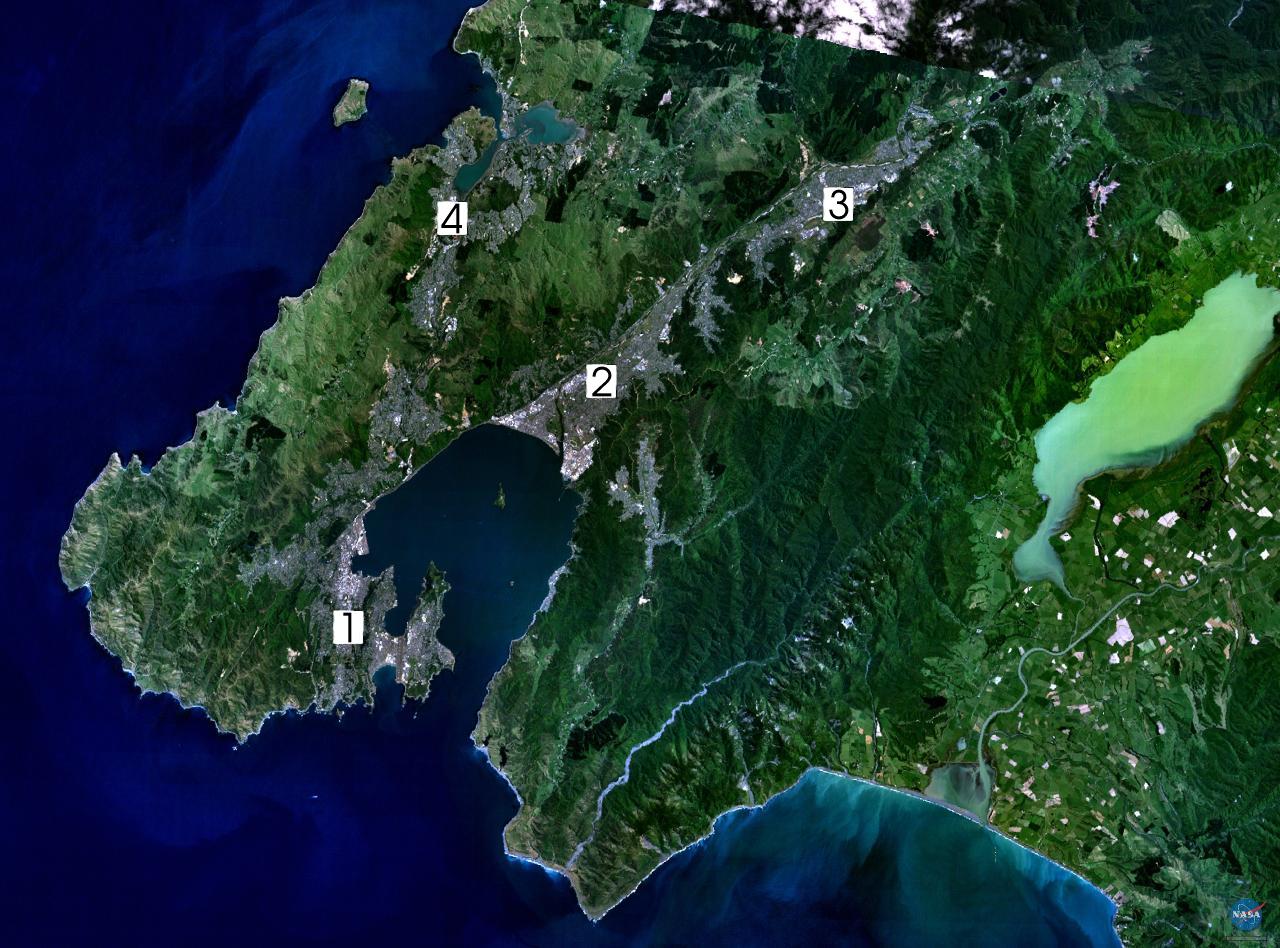
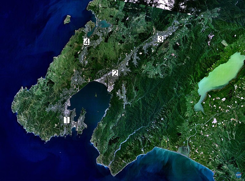
NASA World Wind composite landsat-7 satellite image of Wellington, New Zealand. (1) Central Wellington (2) Lower Hutt (3) Upper Hutt (4) Porirua. English: Satellite photo of the Wellington conurbation: (1) Wellington; (2) Lower Hutt; (3) Upper Hutt; (4) Porirua.
日本語: 人工衛星によるウェリントンの写真。1: ウェリントン、2: ロウワー・ハット (Lower Hutt)、3: アッパー・ハット (Upper Hutt)、4: ポリルア (Porirua)。以上の4市がウェリントン都市圏 (urban area) を構成する
Norsk bokmål: Satelittfoto av Wellingtonregionen. (1) Wellington (2) Lower Hutt (3) Upper Hutt (4) Porirua |
|||
| Font | en:wikipedia | |||
| Autor | NASA, edited by en:User:Clawed | |||
| Permís (Com reutilitzar aquest fitxer) |
|

Historial del fitxer
Cliqueu una data/hora per veure el fitxer tal com era aleshores.
| Data/hora | Miniatura | Dimensions | Usuari/a | Comentari | |
|---|---|---|---|---|---|
| actual | 18:34, 1 set 2005 | | 1.280 × 948 (206 Ko) | Klipp~commonswiki | NASA World Wind composite landsat-7 satellite image of Wellington, New Zealand. (1) Central Wellington (2) Lower Hutt (3) Upper Hutt (4) Porirua. {{PD-USGov-NASA}} |
Ús del fitxer
La pàgina següent utilitza aquest fitxer:
Ús global del fitxer
Utilització d'aquest fitxer en altres wikis:
- Utilització a ast.wikipedia.org
- Utilització a da.wikipedia.org
- Utilització a de.wikipedia.org
- Utilització a el.wikipedia.org
- Utilització a en.wikipedia.org
- Wellington Region
- Hutt Valley
- Lake Wairarapa
- Category:Wikipedians in New Zealand
- User:Ollieinc/Userboxes
- User:Ollieinc/Userboxes/Wider Wellington
- User:Ollieinc/Userboxes/hasWider Wellington
- Wikipedia:Wikipedians in New Zealand user boxes
- Wikipedia:Userboxes/Location/New Zealand
- User:Joseph Pelorus
- User:CatholicKiwi
- User:WG at Dole
- Utilització a eo.wikipedia.org
- Utilització a es.wikipedia.org
- Utilització a fr.wikipedia.org
- Utilització a gl.wikipedia.org
- Utilització a hu.wikipedia.org
- Utilització a ja.wikipedia.org
- Utilització a mi.wikipedia.org
- Utilització a nn.wikipedia.org
- Utilització a no.wikipedia.org
- Utilització a pl.wikipedia.org
- Utilització a pt.wikipedia.org
- Utilització a sv.wikipedia.org
- Utilització a tr.wikipedia.org
- Utilització a uk.wikipedia.org
- Utilització a www.wikidata.org
- Utilització a zh.wikipedia.org