
Fitxer:NATO and the Warsaw Pact 1973.svg

Mida d'aquesta previsualització PNG del fitxer SVG: 450 × 456 píxels. Altres resolucions: 237 × 240 píxels | 474 × 480 píxels | 758 × 768 píxels | 1.011 × 1.024 píxels | 2.021 × 2.048 píxels.
Fitxer original (fitxer SVG, nominalment 450 × 456 píxels, mida del fitxer: 478 Ko)
| Aquest fitxer i la informació mostrada a continuació provenen del dipòsit multimèdia lliure Wikimedia Commons. |
Resum


.svg)
.svg)
.svg)
.svg)
.svg)


.svg)
.svg)
.svg)


.png)
.png)


.svg)


.svg)

.svg)


.svg)
.svg)
.svg)
.svg)


.svg)
.png)


.svg)


.svg)
.svg)


.svg)


.svg)


.svg)
.svg)
.svg)
.svg)
.svg)
.svg)
.svg)
_cropped.svg)
.svg)
.svg)
.svg)
.svg)
.svg)
.svg)
.svg)
.svg)
.svg)
.svg)
.svg)
.svg)
.svg)
.svg)
.svg)
.svg)
.svg)
.svg)
.svg)
.svg)
.svg)
.svg)
.svg)
.svg)
.svg)
.svg)
.svg)
.svg)
.svg)
.svg)
.svg)
.svg)
.svg)
.svg)
.svg)
.svg)
.svg)
.svg)
.svg)
.svg)
.svg)
.svg)
.svg)
.svg)
.svg)
Llicència
Jo, el titular dels drets d'autor d'aquest treball, el public sota la següent llicència:
Aquest fitxer està subjecte a la llicència de Creative Commons Reconeixement i Compartir Igual 3.0 No adaptada.
- Sou lliure de:
- compartir – copiar, distribuir i comunicar públicament l'obra
- adaptar – fer-ne obres derivades
- Amb les condicions següents:
- reconeixement – Heu de donar la informació adequada sobre l'autor, proporcionar un enllaç a la llicència i indicar si s'han realitzat canvis. Podeu fer-ho amb qualsevol mitjà raonable, però de cap manera no suggereixi que l'autor us dóna suport o aprova l'ús que en feu.
- compartir igual – Si modifiqueu, transformeu, o generareu amb el material, haureu de distribuir les vostres contribucions sota una llicència similar o una de compatible com l'original
Registre original de càrregues
This image is a derivative work of the following images:
- File:Blank_map_of_Europe_1956-1990.svg licensed with Cc-by-sa-3.0
- 2011-10-30T04:43:42Z Alphathon 450x456 (485146 Bytes) == {{int:filedesc}} == {{Information |Description={{en|Blank map of Europe showing national borders as they stood from 1956-1990.}} |Source=*[[:File:Blank_map_of_Europe.svg|]] |Date=2011-10-30 04:42 (UTC) |Author=*[[:File:Bla
Uploaded with derivativeFX
Historial del fitxer
Cliqueu una data/hora per veure el fitxer tal com era aleshores.
| Data/hora | Miniatura | Dimensions | Usuari/a | Comentari | |
|---|---|---|---|---|---|
| actual | 11:17, 22 jul 2022 | | 450 × 456 (478 Ko) | Kwamikagami | change to NATO blue; Liecht. not a member |
| 08:43, 30 juny 2016 |  | 450 × 456 (477 Ko) | FreshCorp619 | Reverted to version as of 18:32, 25 February 2012 (UTC) | |
| 08:42, 30 juny 2016 |  | 450 × 456 (728 Ko) | FreshCorp619 | fixed errors | |
| 08:38, 30 juny 2016 |  | 450 × 456 (707 Ko) | FreshCorp619 | Added Byelorussian and Ukrainian SSRs (UN Members) | |
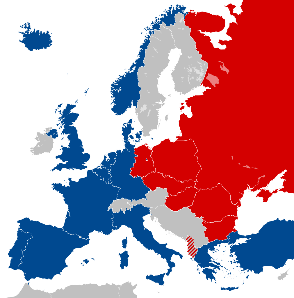
| 20:32, 25 feb 2012 |  | 450 × 456 (477 Ko) | Alphathon | == {{int:filedesc}} == {{Information |Description={{en|Map of Europe showing NATO and the Warsaw Pact circa 1973.}} |Source={{Derived from|Blank_map_of_Europe_1956-1990.svg|display=50}} |Date=2012-02-25 18:31 (UTC) |Aut... |
Ús del fitxer
Les 21 pàgines següents utilitzen aquest fitxer:
- Ampliació de la Unió Europea de 2004
- Bloc de l'Est
- Consell d'Assistència Econòmica Mútua
- Doctrina Bréjnev
- Economia de la Unió Soviètica
- Història de la Unió Soviètica (1953-1985)
- Història de la Unió Soviètica (1985-1991)
- Història de la Unió Soviètica i la Rússia Soviètica (1917-1927)
- Pacte de Varsòvia
- República Democràtica Alemanya
- República Democràtica de Finlàndia
- República Federal Socialista de Iugoslàvia
- República Popular d'Albània
- República Popular d'Hongria
- República Popular de Bulgària
- República Popular de Polònia
- República Socialista Federativa Soviètica de Rússia
- República Socialista Txecoslovaca
- República Socialista de Romania
- Unió de Repúbliques Socialistes Soviètiques
- Plantilla:Europa Oriental Comunista
Ús global del fitxer
Utilització d'aquest fitxer en altres wikis:
- Utilització a als.wikipedia.org
- Utilització a ar.wikipedia.org
- Utilització a de.wikipedia.org
- Utilització a el.wikipedia.org
- Utilització a en.wikipedia.org
- History of the Soviet Union (1982–1991)
- East Germany
- Warsaw Pact
- History of Soviet Russia and the Soviet Union (1917–1927)
- Byelorussian Soviet Socialist Republic
- History of the Soviet Union (1953–1964)
- Socialist Republic of Romania
- Democratic Federal Yugoslavia
- Socialist Federal Republic of Yugoslavia
- Polish People's Republic
- Ukrainian Soviet Socialist Republic
- History of Czechoslovakia (1948–1989)
- History of the Soviet Union (1927–1953)
- History of Poland (1945–1989)
- Czechoslovak Socialist Republic
- Template:Communist Eastern and Central Europe
- People's Republic of Bulgaria
- Hungarian People's Republic
- History of East Germany
- People's Socialist Republic of Albania
- History of the Soviet Union (1964–1982)
- User:Peterstrempel/Soviet-Brezhnev-draft
- History of the Soviet Union
- History of NATO
- User:Y-S.Ko/Wikipedia course/History
- User:Falcaorib
- Bibliography of the Russian Revolution and Civil War
- Bibliography of Stalinism and the Soviet Union
- Bibliography of the post-Stalinist Soviet Union
- Utilització a et.wikipedia.org
- Utilització a fi.wikipedia.org
- Utilització a hy.wikipedia.org
- Utilització a id.wikipedia.org
- Jerman Timur
- Uni Soviet
- Republik Sosialis Federasi Soviet Rusia
- Pakta Warsawa
- Pembubaran Uni Soviet
- Templat:Communist Eastern Europe
- Blok Timur
- Comecon
- Republik Sosialis Soviet Byelorusia
- Republik Sosialis Soviet Ukraina
- Republik Rakyat Bulgaria
- Republik Rakyat Polandia
- Republik Sosialis Cekoslowakia
- Republik Rakyat Hungaria
Vegeu més usos globals d'aquest fitxer.