
Fitxer:Un-ethiopia.png
Fitxer original (3.038 × 2.257 píxels, mida del fitxer: 1,6 Mo, tipus MIME: image/png)
| Aquest fitxer i la informació mostrada a continuació provenen del dipòsit multimèdia lliure Wikimedia Commons. |
Resum
| Descripció |
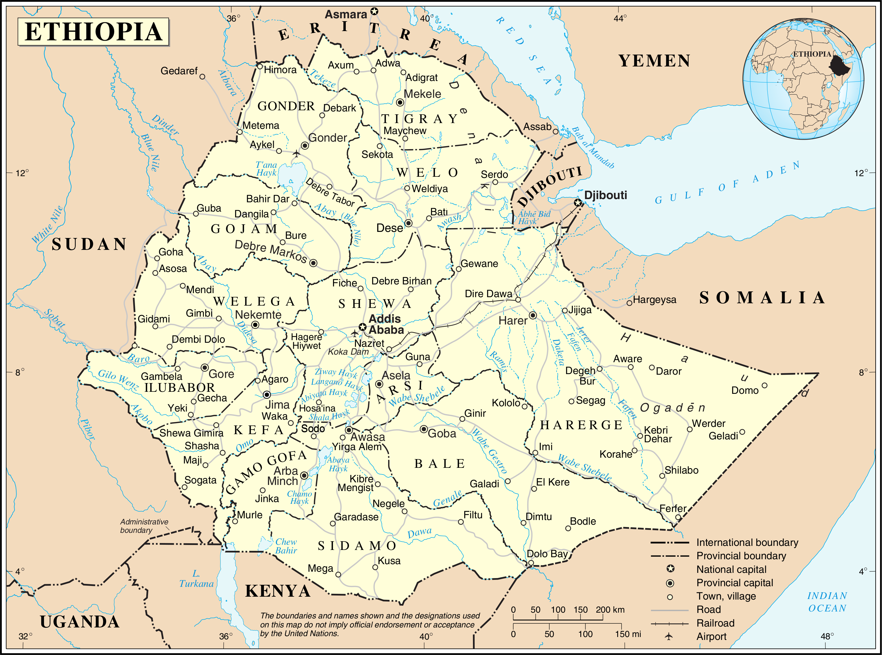
English: This map is not up to date. The internal borders show the provinces which were replaced by regions/states in 1995.
Nederlands: Deze kaart is verouderd. De interne grenzen tonen de provincies die in 1995 werden vervangen door regio's/staten. |
|||
| Data | ||||
| Font | The United Nations Cartographic Section (UNCS) | |||
| Autor | Cartographer of the United Nations | |||
| Permís (Com reutilitzar aquest fitxer) |
|

Historial del fitxer
Cliqueu una data/hora per veure el fitxer tal com era aleshores.
| Data/hora | Miniatura | Dimensions | Usuari/a | Comentari | |
|---|---|---|---|---|---|
| actual | 03:00, 24 oct 2007 | | 3.038 × 2.257 (1,6 Mo) | Jeroen | {{UN map}} Category:Maps of Ethiopia |
Ús del fitxer
Les 2 pàgines següents utilitzen aquest fitxer:
Ús global del fitxer
Utilització d'aquest fitxer en altres wikis:
- Utilització a ckb.wikipedia.org
- Utilització a en.wikipedia.org
- Utilització a eo.wikipedia.org
- Utilització a fa.wikipedia.org
- Utilització a fr.wikipedia.org
- Utilització a id.wikipedia.org
- Utilització a mzn.wikipedia.org
- Utilització a nl.wikipedia.org
- Utilització a pl.wiktionary.org
- Utilització a uk.wikipedia.org
- Utilització a ur.wikipedia.org
- Utilització a vi.wikipedia.org
- Utilització a www.wikidata.org